UPDATES: July 2012
UPDATES is a monthly email newsletter on stormwater management, assessment (including monitoring), and maintenance research at St. Anthony Falls Laboratory and the University of Minnesota.
Click HERE to subscribe to UPDATES Newsletter
Or Text SWUPDATES to 22828 to Join. Message and data rates may apply.
For Email Marketing you can trust
Stormwater to baseflow? Investigating baseflow sources in Minnehaha Creek and the potential to augment through stormwater infiltration
July 2012 (volume 7 - issue 7)
Contributed by Trisha Moore, Research Associate, St. Anthony Falls Laboratory, University of Minnesota
Funded by Minnehaha Creek Watershed District and Mississippi Watershed Management Organization
Project Collaborators: John S. Gulliver1, John L. Nieber2, and Joe Magner2
1St. Anthony Falls Laboratory, University of Minnesota
2Bioproducts and Biosystems Engineering, University of Minnesota
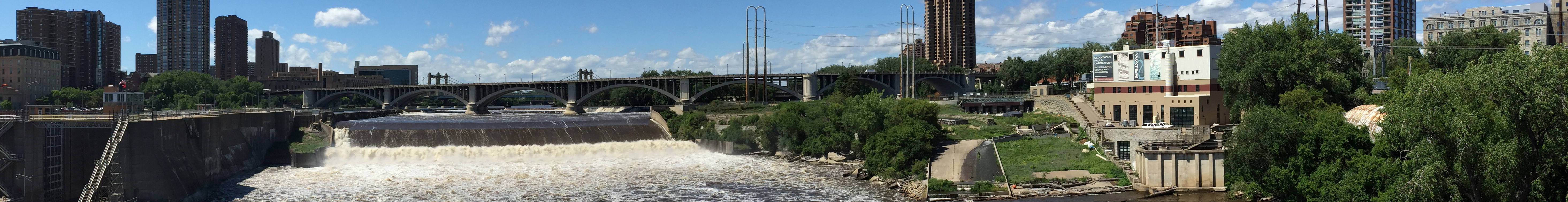
Coursing 22 miles from its origin at Lake Minnetonka to its confluence with the Mississippi River (Figure 1), Minnehaha Creek ranks among the Twin Cities’ most valued surface water features. Each year roughly half a million visitors flock to the creek’s popular park and falls area in South Minneapolis and have included figures such as President Lyndon B. Johnson (Figure 2). Flow in Minnehaha Creek is heavily dependent on discharge from Lake Minnetonka, the outlet of which is controlled to manage water elevations in the lake. When precipitation is sufficient to maintain adequate levels in the lake, flow in the creek is sustained. However, as has occurred in 8 of the last 12 years, when outflow from Lake Minnetonka is cut off, Minnehaha Creek runs dry and along with this many of its recreational benefits are diminished.

Figure 1: Minnehaha Creek flows 22 miles from the outlet of Lake Minnetonka to its famous falls area near its confluence with the Mississippi River. Potential sources of baseflow in the stream include discharge from the watershed’s lakes, the remaining wetlands, and the shallow groundwater system. Quantifying the relative contributions of these sources is one of the aims of this study. With the exception of the lakes and wetland areas denoted on the map, the remainder of the watershed below Lake Minnetonka is developed/urbanized.

Figure 2: A photo of President Lyndon B. Johnson, smiling as he views Minnehaha Falls during his visit to the Twin Cities in June 1964. The visit coincided with a drought during which flow in the creek had ceased. To provide the President with a view of the falls, the City released 6 million gallons of water from Minneapolis fire hydrants (Halleberg, 1995).
The frequency with which dry or extremely low flow conditions occur in Minnehaha Creek combined with the flashy nature of urban runoff also contribute to its impaired status for biotic integrity (Figure 3). Stormwater management efforts in the watershed are beginning to reflect local interest in enhancing both the recreational and ecological benefits provided by Minnehaha Creek. Is it possible that stormwater runoff from the creek’s urbanized watershed could be managed to improve flow (and biological) conditions in the creek, including during drought periods?

Figure 3: Outflow from Lake Minnetonka at Grays Bay and discharge 20 miles downstream at a USGS gauging station (Hia. Ave.) during 2009. Apart from the moderating effects of discharge from Lake Minnetonka (as seen during May of 2009), flow conditions in the creek are quite flashy. For example, the time from the hydrograph peak to 0 flow can be as short as 6 to 7 days. Extremes in flow conditions are exacerbated by expedient stormwater drainage throughout the creek’s urbanized watershed.
We hypothesize that stormwater can augment stream baseflow through strategic infiltration and storage of stormwater runoff in the shallow aquifer system. To test this hypothesis, we must first develop an understanding of current interactions between the creek and the shallow groundwater system. We are doing so through a variety of approaches, including analysis of historic stream flow records and field measurements. We have analyzed stream flow records to examine trends in flow over time and in relation to discharge from Lake Minnetonka. Through these streamflow-based methods, we estimate that baseflow contributes, on average, the equivalent of 1.5 inches of flow annually (or, an average daily flow of 5.3 cfs). Following the method of Brutsaert and Nieber (1977), the rate of change in flow during drought periods was also analyzed to infer physical characteristics of the shallow aquifer. The results of this approach indicated that only a very small percent (< 1%) of the watershed’s aquifer contributes flow to the creek. These results corroborate with existing surficial geologic datasets (Tipping, 2011), which indicate that vertical loss from the watershed’s uppermost (quaternary) aquifer to the underlying bedrock aquifers is rapid, with a median travel time of 0.5 years.
We are also using multiple lines of evidence to examine stream-groundwater interactions and identify sources of flow to the creek in the field. Stream and pore water temperatures are a useful indicator of groundwater inflow due to temperature differences between the creek and groundwater. Temperature measurements in the stream and shallow subsurface waters are being taken throughout the length of Minnehaha Creek to gain insight as to which reaches of the stream may be gaining or losing water. Seepage meters will be used to measure flow into (or out of) the creek at low flow conditions later this year. In addition to differences in temperature, ground- and surface waters also tend to differ in their isotopic composition due to processes such as evaporation, through which isotopes fractionate or change in their relative abundance. Water samples collected from the creek during high and low flow conditions will be analyzed for their isotopic compositions of hydrogen and oxygen. The same analysis is being conducted on samples collected from the creek’s flow sources, including local precipitation, stormwater runoff, lake waters, and shallow groundwater. The isotopic “signature” of these source waters relative to that of the creek will serve to further improve our understanding of existing sources of flow in the creek. Piezometers installed in the creek’s riparian corridor will be monitored to observe changes in groundwater elevation over time and to better understand the potential to utilize this storage reservoir to meet the objectives of stormwater management and stream baseflow enhancement.

Figure 4: Initial investigations of surface water temperature (blue diamonds and brown dashes) and pore water temperatures in streambed sediments (green triangles) are being used to identify gaining and losing reaches of the stream. Pore water temperature that is close to surface water temperature may indicate that the stream is losing water to the groundwater table.

Figure 5: Seepage meters, which are inserted into streambed sediments as shown above, will be used in concert with temperature measurements input into a computational model to quantify groundwater flux into or out of the stream (photo from Rosenberry and LaBaugh, 2008).
The results of streamflow and field analysis will be used to support modeling of the connectivity between Minnehaha Creek and its contributing aquifer system. Through modeling, our objective is to identify strategic locations where infiltrated stormwater can be stored and eventually discharged to the creek as baseflow. This information can then be used to guide multi-objective stormwater planning in the watershed to enhance the stream’s recreational benefits while improving its overall ecological health.
References
- Brutsaert, W. Nieber, J.L. 1977. Regionalized drought flow hydrographs from a mature glaciated plateau. Water Resources Research 13(3): 637-643.
- Hallberg,, J.K. 1995. Minnehaha Falls – Living Waters. J.D. Theuson Publishing: Stillwater, MN.
- Rosenberry, D.O., LaBaugh, J.W. 2008. Field techniques for estimating water fluxes between surface water and ground water: U.S. Geological Survey Techniques and Methods 4-D2.
- Tipping, R.G. 2011. Distribution of vertical recharge to upper bedrock aquifers Twin Cities Metropolitan Area. Minnesota Geological Survey, Report 10I021.
- USGS National Water Information System: Web Interface. USGS 05289800 Minnehaha Creek at Hiawatha Ave. in Minneapolis, MN. Retrieved from http://waterdata.usgs.gov/nwis/nwisman/?site_no=05289800&agency_cd=USGS.
We want to hear from you!!!
Let us know your thoughts, experiences, and questions by posting a comment. To get you thinking, here are a few questions:
- What challenges, if any, to baseflow management in developing areas have you experienced?
- If you have tackled such challenges, what types of solutions have been successful (or unsuccessful)?